Beats
Find a beat, understand its current state, and review its access before planning.
Find the right beat
Search by name, code, river, or lodge. Use status and lodge filters to narrow the list, then compare availability, active assignments, capacity, travel time, and weather.
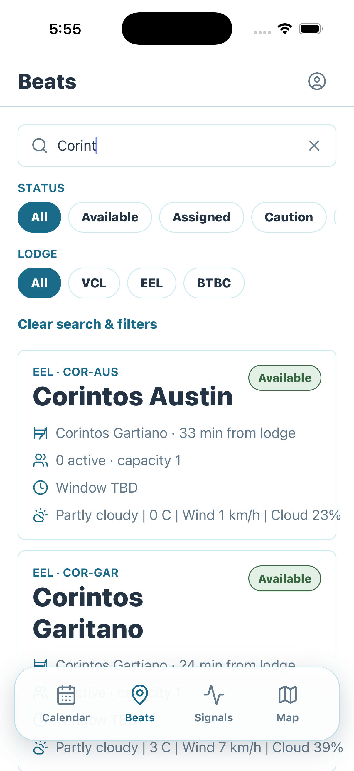
Review Beat detail
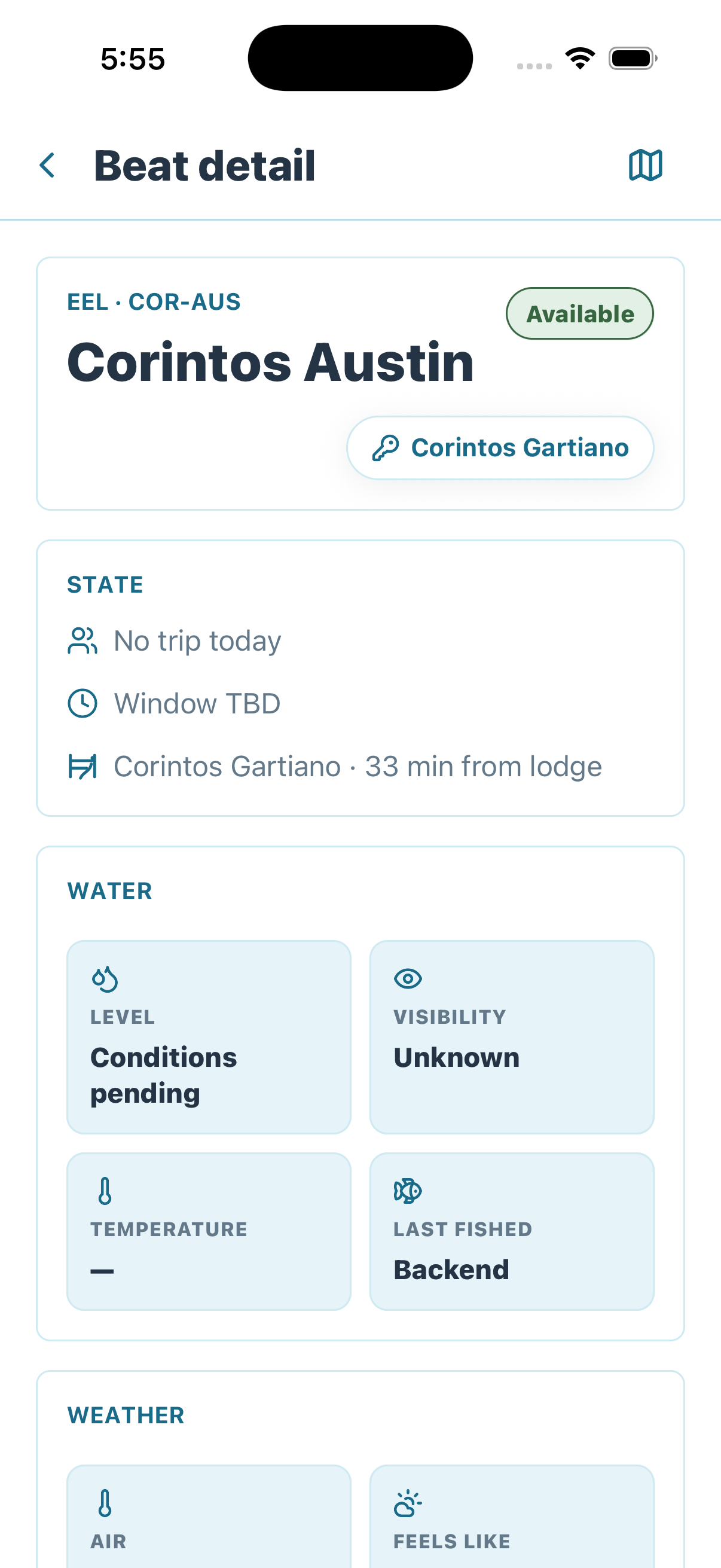
Open a beat before treating it as suitable. Confirm its current availability, associated access, trip and window state, distance from the lodge, water conditions, and weather.
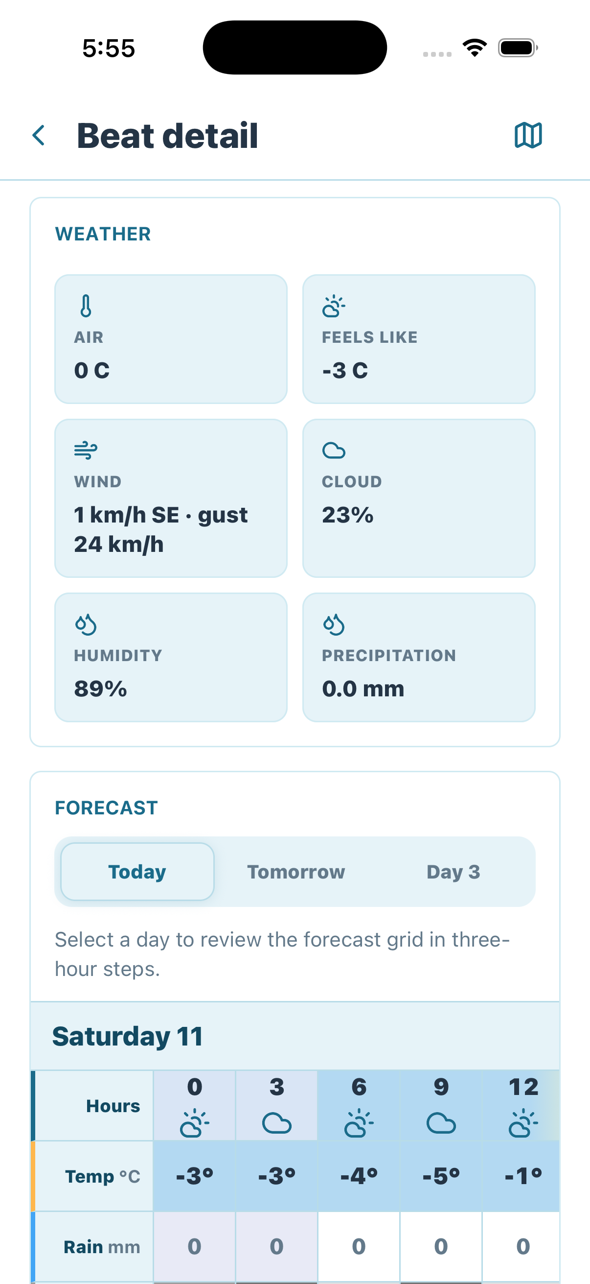
Review conditions and forecast
Scroll through Beat detail to compare current air temperature, wind and gusts, cloud cover, humidity, and precipitation. Use the forecast tabs and three-hour grid to understand how the fishing window may change—not just how conditions look now.
Locate the beat and its access
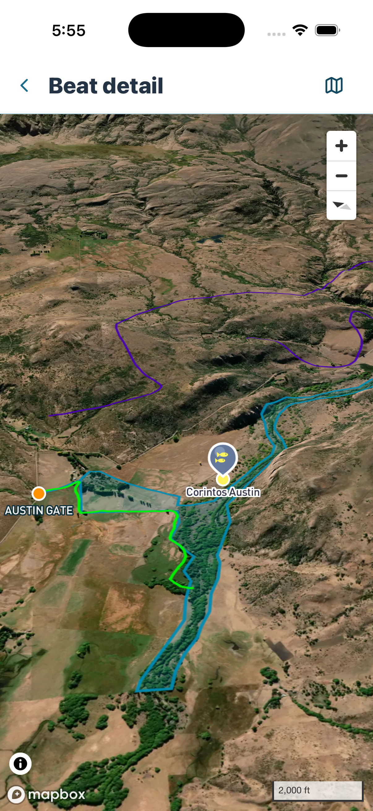
Open the map from Beat detail to understand the geographic relationship between the fishing location and its associated access. Use it for orientation; confirm the Access detail instructions before deciding how to enter.
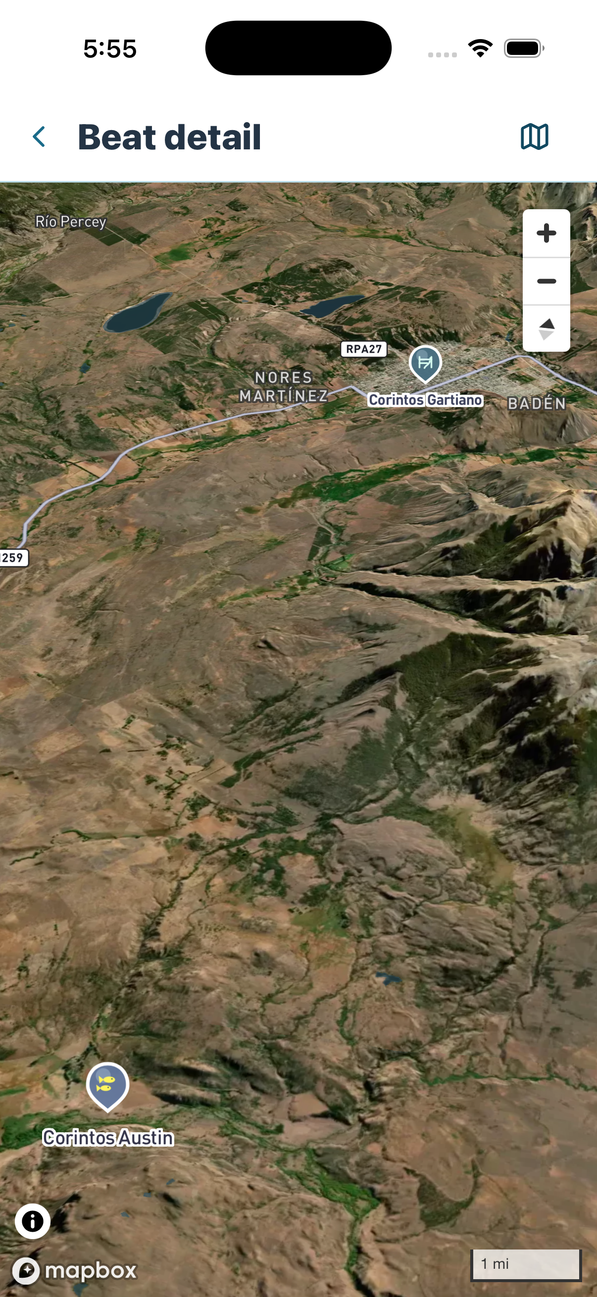
Zoom in to read the Beat boundary, access or gate point, and available route overlays. The boundary explains where the Beat is located; it does not by itself grant entry or replace the access instructions.
Review Access detail
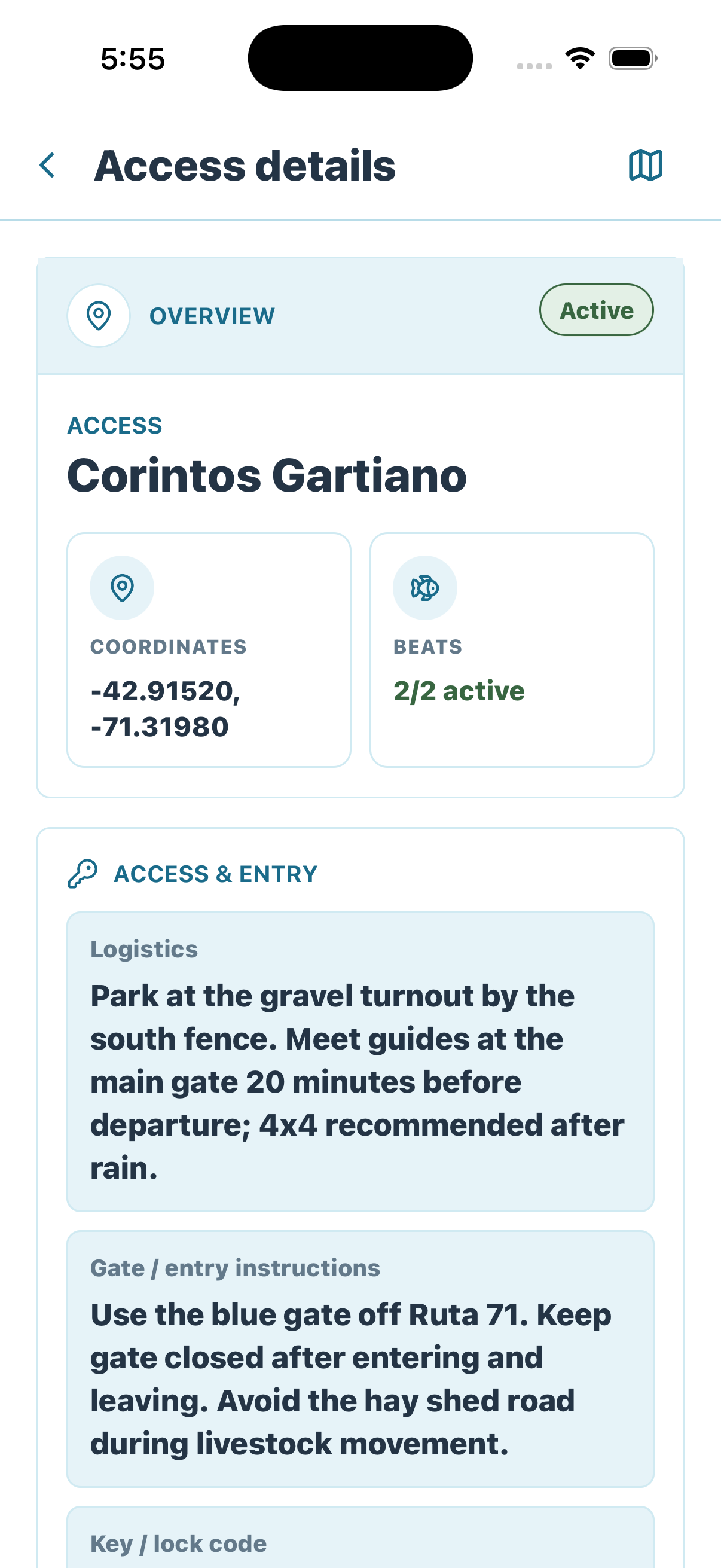
Open the linked access before planning entry. Confirm that it is active, verify its coordinates and associated Beats, then read the logistics, gate or entry instructions, and key or lock information. These instructions are the operating source for how to enter and leave the property.
Read Access detail before entering
A map marker or route shows where to go. Access detail explains how entry must happen, including gate handling, vehicle requirements, timing, and property restrictions.
Next: review Signals.